-
Home
-
- About
-
Upazila Parishad
উপজেলা কমিটির সভার রেজুলেশন(২য় অংশ)
-
উপজেলা প্রাথমিক ও গণশিক্ষা কমিটি
-
উপজেলা মৎস্য ও প্রাণিসম্পদ
-
উপজেলা মহিলা ও শিশু উন্নয়ন কমিটি
-
উপজেলা মাধ্যমিক ও মাদ্রাসা শিক্ষা কমিটি
-
উপজেলা যুব ও ক্রীড়া উন্নয়ন কমিটি
-
উপজেলা যোগাযোগ ও ভৌত অবকাঠামো উন্নয়ন কমিটি
-
উপজেলা স্বাস্থ্য ও পরিবার কল্যাণ কমিটি
-
উপজেলা জনস্বাস্থ্য, স্যানিটেশন ও বিশুদ্ধ পানি সরবরাহ কমিটি
-
উপজেলা প্রাথমিক ও গণশিক্ষা কমিটি
- Administration
- Govt. Offices
- Different Institutions
- Gallery
-
Quiz
মেনু নির্বাচন করুন
-
Home
-
-
About
Upazila identity
History-Tradition
Geographical and Economic
-
Upazila Parishad
উপজেলা পরিষদের পরিচিতি
বাজেট
বার্ষিক উন্নয়ন পরিকল্পনা
পঞ্চবার্ষিক পরিকল্পনা
বার্ষিক আর্থিক প্রতিবেদন
এডিপি অগ্রগতি প্রতিবেদন
মাসিক সমন্বয় সভার কার্যবিবরণী
উপজেলা কমিটির সভার রেজুলেশন
উপজেলা কমিটির সভার রেজুলেশন(২য় অংশ)
- উপজেলা প্রাথমিক ও গণশিক্ষা কমিটি
- উপজেলা মৎস্য ও প্রাণিসম্পদ
- উপজেলা মহিলা ও শিশু উন্নয়ন কমিটি
- উপজেলা মাধ্যমিক ও মাদ্রাসা শিক্ষা কমিটি
- উপজেলা যুব ও ক্রীড়া উন্নয়ন কমিটি
- উপজেলা যোগাযোগ ও ভৌত অবকাঠামো উন্নয়ন কমিটি
- উপজেলা স্বাস্থ্য ও পরিবার কল্যাণ কমিটি
- উপজেলা জনস্বাস্থ্য, স্যানিটেশন ও বিশুদ্ধ পানি সরবরাহ কমিটি
-
Administration
Upazila Executive Officer
About Organization
Programs and Meetings
সেবা ও অন্যান্য
-
Govt. Offices
About law and order
Health related
Agriculture and food related issues
About Land
Engineering and Information Technology
Human Resources Development
About Education
-
Different Institutions
Educational Institution
Private Organizations
-
Gallery
ফটো গ্যালারী
ভিডিও গ্যালারী
-
Quiz
Main Comtent Skiped
Rampal At a Glance
General Information
| District | Bagerhat | |
| Upazila | Rampal | |
|
Boundary
|
Fakirhat and Bagerhat sadar are situated to the North, Mongla situated to the south, Dakop Upazila of Khulna district situated to the West, and Morrelganj Upazila is situated to the East of Rampal. | |
| Distance from District | 24 K.M. | |
| Area | 335.45 Square Kilometer | |
| Population | 154965 People (about) | |
| Man | 77504 (about) | |
| Woman | 77461 (about) | |
| The density of the number of people | 462 People/Sq. K.M. | |
| Total number of voters | 111028 people | |
| Mail Voters | 55681 people | |
| Woman Voters | 55347 people | |
| Annual population growth rate | (-)1.38% | |
| Total family (Khana) | 38,173 | |
| Election area | Bagerhat-03 (Rampal, Mongla) | |
| Village | 134 | |
| Mouza | 118 | |
| Union | 10 | |
| Municipality | 0 | |
| Government orphanage | 01 | |
| Non-Government orphanage | 17 | |
| Masjid | 204 | |
| Mandir | 68 | |
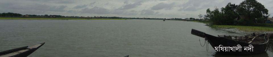
| River | 05 (Kumarkhali, Mongla, Daudkhali, Katanadi and Bogura river) | |
| Hat Bazaar | 20 | |
| Bank branch | 08 | |
| Post Office/Sub-Post Office | 29 | |
| Teliphone Exchange | 01 | |
| Small cottage industry | 02 | |
| Large industry | 01 (Thermal power plant) |
| Agriculture related |
| Total amount of land | 27,644 hectares | |
| Exact crop land | 19,306 hectares | |
| Total Crop Land | 20,718 hectares | |
| One season crop land | 18,100 hectares | |
| Two season crop land | 1,000 hectares | |
| Three season crop land | 206 hectares | |
| Deep tube well | 01 | |
| Non-deep tube well | 185 | |
| Power driven pump | 845 | |
| Yearly food demand | 30545 Metric tons |
| Education related |
| Government primary school | 67 | |
| Non-Government primary school | 56 | |
| Community Primary School | 03 | |
| Junior high school | 13 | |
| High school (co-education) | 31 | |
| High school (Girls) | 02 | |
| Dakhil Madrasa | 10 | |
| Alim Dakhil Madrasa | 03 | |
| Fazil Madrasa | 04 | |
| Kamil Madrasa | 0 | |
| College (co-education) | 02 | |
| college (Girls) | 01 | |
| Literacy rate | 58.0% | |
| 59.6% | ||
| Female | 56.4% |
| Health related |
| Upazila Health Complex | 01 | |
| Upazila Health and Family Welfare Center | 16 | |
| Number of beds | 50 | |
| The number of allowed post for doctors | 30 | |
| Number of working doctors | 05, UHC-00, In Union-00, UHFPO-01 | |
| Number of Senior Nurse | 15 | |
| Number of Assistant Nurse | 01 |
| Land and revenue related |
| Mouza | 117 | |
| Union Land Office | 05 | |
| Municipal land office | 0 | |
| Total khas land | 1578.03 acres | |
| Agriculture | 1498.85 acres | |
| Non-agricultural | 12.1 acres | |
| Settlementable agriculture | 1578.03 acres (agricultural) | |
| Annual land development tax (demand) |
General = 44,68,378 / -
Agency = 9912,928 / - |
|
| Number of Hat-market | 21 |
| Contact related |
| Concrete road | 104.56 kilometers | |
| Half Concrete Road | 124.35 kilometers | |
| Soil road | 415.94 km | |
| Number of bridges / culvert | 258 (Gope 3386) | |
| Number of Roads | 270 |
| Family planning |
| Health and Family Welfare Center | 10 | |
| Family planning clinic | 09 | |
| M.C.H. The unit | 01 | |
| The number of able couples | 32992 people |
| Fish related |
| Number of ponds | 702 | |
| Government Fisheries Service Center | 01 | |
| Number of fishermen (registered year 2013) | 2355 (maritime and local fishermen) | |
| Yearly fisheries demand | 3301.05 Metric tons | |
| Annual fishery production | 7315.31 Metric tons |
| Livestock |
| Upazila Animal Medical Center | 01 | |
| The number of veterinary doctors | 02 BCS, 04 Diplomats | |
| Artificial breeding center | 02 | |
| Number of Points | 0 | |
| The number of developed chicken farms | 62 | |
|
Number of farms containing Layer 800 and have 10-49 chickens |
876- | |
| Cattle farm | 45 | |
| Broiler chicken farm | 131 | |
| Goat farm | 212 |
| Cooperative Related |
| Central Co-operative Society Ltd. | 01 | |
| Merchant Co-operative Society Ltd. | 11 | |
| Union multipurpose co-operative society Ltd. | 10 | |
| Multipurpose Co-operative Society Ltd. | 04 | |
| Fisheries Cooperative Society Ltd. | 03 | |
| Youth Co-operative Society Ltd. | 01 | |
| Housing Multipurpose Cooperative Society | 08 | |
| Farmer Co-operative Society Ltd. (Pubo) | 06 | |
| Male Poor Co-operative Society Ltd. | 0 | |
| Kulimujur Samity Ltd. | 05 | |
| Savings and Loans Co-operative Society Ltd. | 11 | |
| Other Cooperative Societies | 0 | |
| Fisheries Farm Cooperative Association | 02 |


Site was last updated:
2025-06-04 18:18:10
Planning and Implementation: Cabinet Division, A2I, BCC, DoICT and BASIS
Technical Assistance:
![]()
Developed By:
